
Technical area

Inside MAPEXIS
Technical notes on the game: what makes it different and how it keeps changing. This explains what each piece does, not how it's programmed.
Summary
MAPEXIS is a delivery game set on the real world map, built from scratch for the browser with Three.js and no commercial game engine. Coastlines, straits, countries and cities come from public geographic data, and everything that happens at sea is calculated against that real coastline. The game rests on one rule: while you move there's no GPS, so you have to carry the geography in your head.
1The real world map, in 3D
The land is built from Natural Earth outlines at the largest scale (1:10 million): every continent and island becomes a raised piece, slightly above the sea and with its cliff, and lakes are cut out separately. The map is flat, with north always up and a camera that never rotates, so what you learn on one trip helps you on the next.
The world is drawn three times side by side, so you can cross the Pacific over the date line without seeing the edge. The light follows the sun: a day lasts 24 minutes, with warm sunrises and sunsets and dark nights.
2A coastline you can't cross
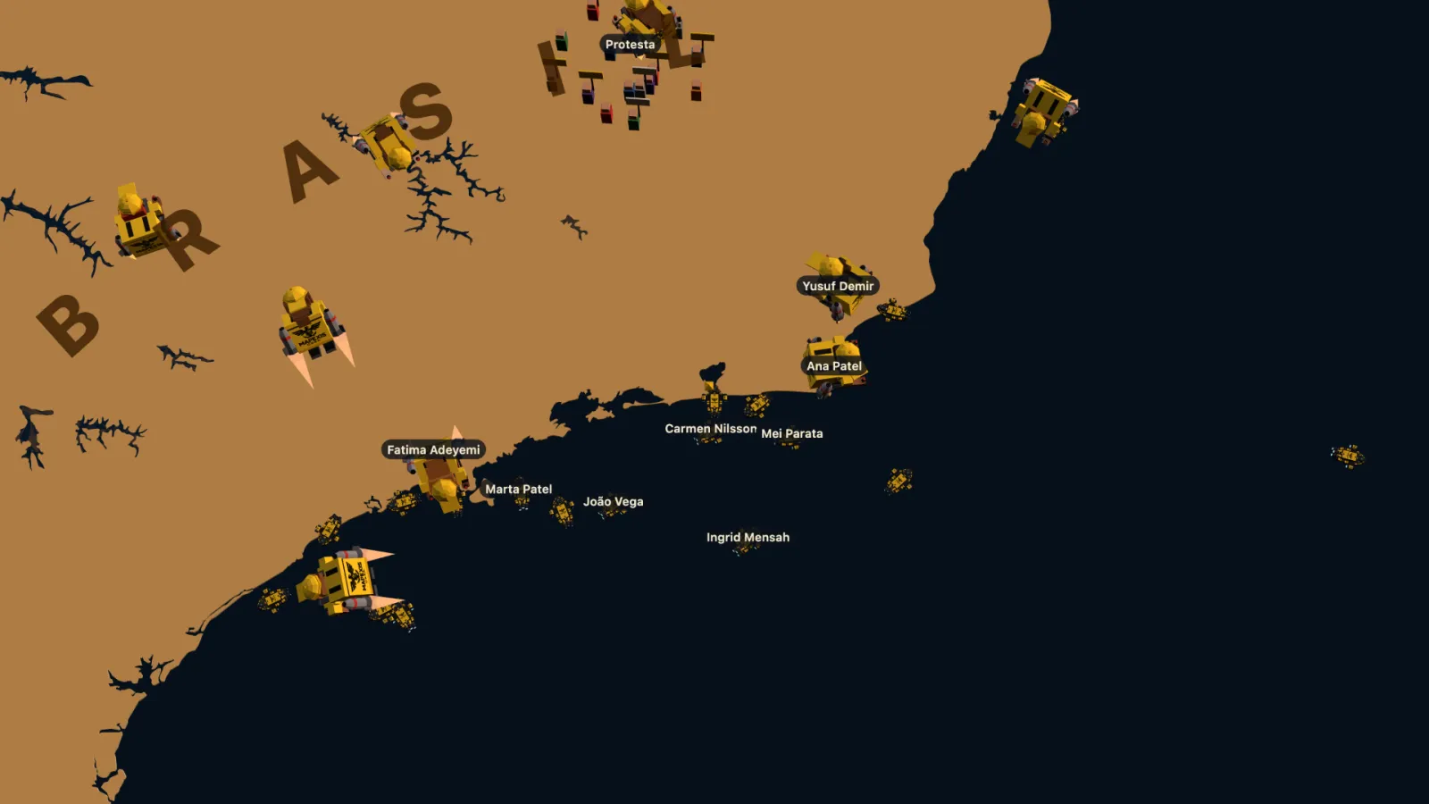
The ship only sails the sea, and the coast is the real one. Every simulation step is checked against the real outlines: the ship stops in about two tenths of a second without crashing and, if you keep pushing against the shore, slides along it. It never goes through, however fast the computer runs, because the physics advances at a fixed rate.
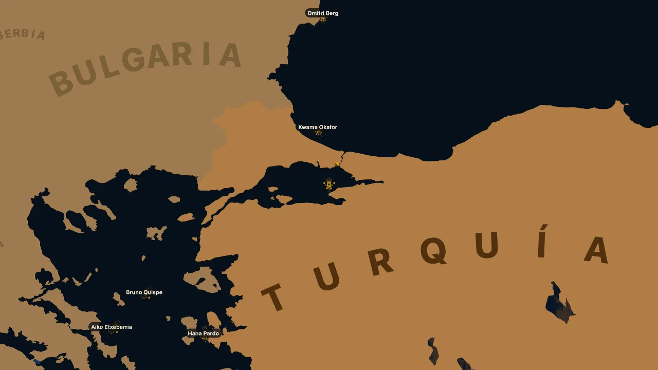
Narrow passages are measured one by one so the ship fits: the Bosphorus, the Dardanelles, Kerch, Gibraltar, the Danish straits, Hormuz and Bab-el-Mandeb. The Panama, Suez, Kiel and Corinth canals, which are land on the map, are crossed automatically when you enter their mouth. On foot it's the other way round: the jetpack doesn't fly over open sea, it only clears narrow stretches of water.
3Navigating without GPS
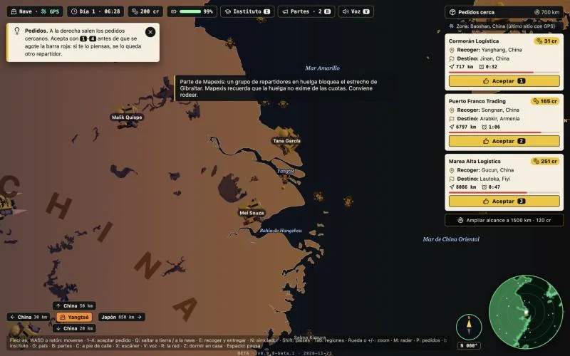
The rule that defines the game: the ship and the jetpack blind the GPS. On the move, the radar shows only static. When you stop completely, it starts calibrating after 0.8 seconds and the signal returns after 3 seconds: then you see your position, the ship, your home and the destination.
What you do have on the move is the map overlay (Shift): names of countries, seas and capitals over the map. Every country on screen carries its full name inside the visible area, without overlapping the others or the panels. Names, never the route.
- Calibration0.8 s stopped
- Signal3 s stopped
- On the movestatic, heading and compass
4172,046 places to live
When you sign up you choose your home among every place in the world with more than a thousand people listed by GeoNames: 172,046. The search understands names with or without accents, by word and in your language, and if it finds nothing it says so and suggests similar ones; it never picks one for you at random.
The ship appears in the open sea closest to your home. For that the game carries a mask of the connected ocean: from Madrid you set off into the Mediterranean, and from Baku never into the Caspian, which is a closed sea. Destinations are real cities of over a hundred thousand people, drawing the country first so the same ones don't keep coming up.
5Sea routes
Every job is measured by its real sea route, not a straight line, and the deadline comes from sailing it without getting lost. Routes are searched on a grid of the ocean in which cells next to the coast cost more, so they prefer open water and don't cut corners. Where the grid is too coarse, the leg is redone finely against the real coastline, with cells down to about a hundred metres in the Bosphorus.
The player never sees that route while working: only the other couriers use it, and the route simulator, which explains it to you before you set off.
6A network with a life of its own
Seventy couriers work at the same time as you. Each has a name, an age, a home, a family, instalments and a balance. Far from you, each one is just a calculation that takes as long as their trip would; when they enter your area they become a real ship that sails, goes ashore, picks up and delivers. At the end of the day they pay their costs, and whoever goes broke goes under and leaves their place.
To make the traffic believable there are capacity limits per area and per landing point, lanes at sea and right-of-way rules: ships follow the one ahead instead of ramming it and pass on the right. All the models are merged into a single mesh, and the whole network costs about 2 milliseconds per frame.
7Real weather and news
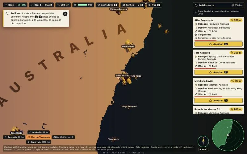
Storms follow eleven real basins, each with its type and its season according to the real month: Atlantic hurricanes from June to November, north-west Pacific typhoons all year, Indian Ocean cyclones from November to April. If the US National Hurricane Center has an active storm, it appears where it is and with its name. Inside one, you're dragged towards the eye and the ship handles worse.
Every country has its card with real data: who governs (Wikidata), the homicide rate (World Bank and UNODC) and the day's headlines about protests and strikes (GDELT). When something in the game is real, a note outside the fiction says so, with the source, the date and the link.
8Learning by playing
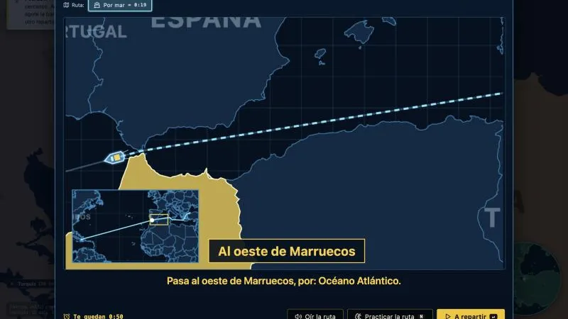
Before you set off, the route simulator tells the trip leg by leg: which coast you pick up on, which countries you leave to the east or west, which seas you cross and where to land. A voice narrates it while a dot travels across the map, and you can practise it with the clock almost stopped. If pick-up and delivery are on the same continent, it also offers the overland route, with the time for each.
The Mapexis Institute has courses on oceans, seas, countries by continent and the regions of each country. You study by clicking on the map and sit a twelve-question exam; with 80 % you get a certificate and a grant.
9Models and video made with code
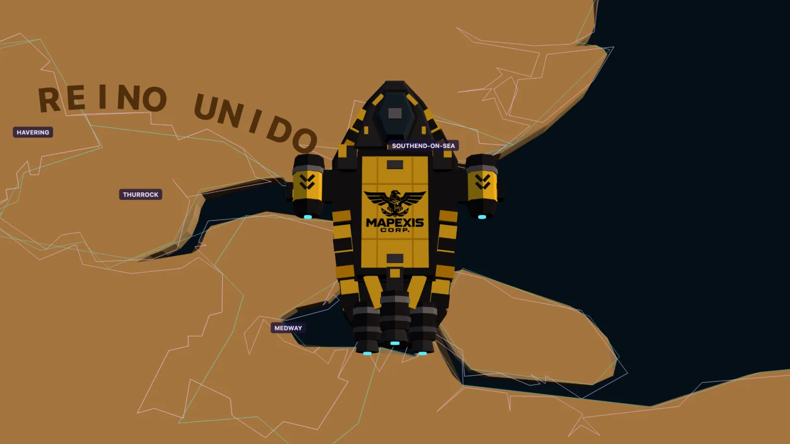
The ship and the courier are low poly and are assembled piece by piece on the spot, following the original designs: plated armour, nacelles, thrusters, a striped backpack, rockets with a red band and layered flames. There are no model files to download.
The Mapexis Corp. welcome video isn't a video either: it's thirty-four scenes drawn live, in 2D and with the game's 3D models, with synthesized music and subtitles in your language.
10Technologies
No game engine and no framework: hand-written JavaScript, with Three.js for 3D.
- Languages
The game in modern JavaScript; the data preprocessing in Node.js.
JavaScript (ES2022, módulos)HTML5CSSNode.js- Graphics
World, ships and couriers in 3D with WebGL; labels and radar in Canvas 2D.
Three.js r181WebGLCanvas 2Dearcut- Data
Geography from public sources, turned into compact binary files before publishing; the day's news from open services.
Natural Earth 10mGeoNamesWikidataBanco MundialGDELTNHC- Sound and voice
Effects synthesized with Web Audio; the route lesson is read by the browser's voice.
Web Audio APIWeb Speech APIMP3- Server
No servers of our own to maintain: CDN hosting and one cloud function for beta feedback.
AWS AmplifyAmazon CloudFrontAWS LambdaAmazon DynamoDBAmazon SES- Tools
Builds with Vite and automated tests for the physics, the coastline, narrow passages and routes.
ViteVitestGit
What's new
First open beta at play.mapexis.com: a living world with seventy couriers, real storms and news, a route simulator with voice, the Mapexis Institute, canals and a button to send your feedback.
MAPEXIS goes back to the workshop: it is rebuilt in low poly 3D on top of the 2D prototype from February, keeping the character, the ship and the rule of sailing without GPS.